Portfolio
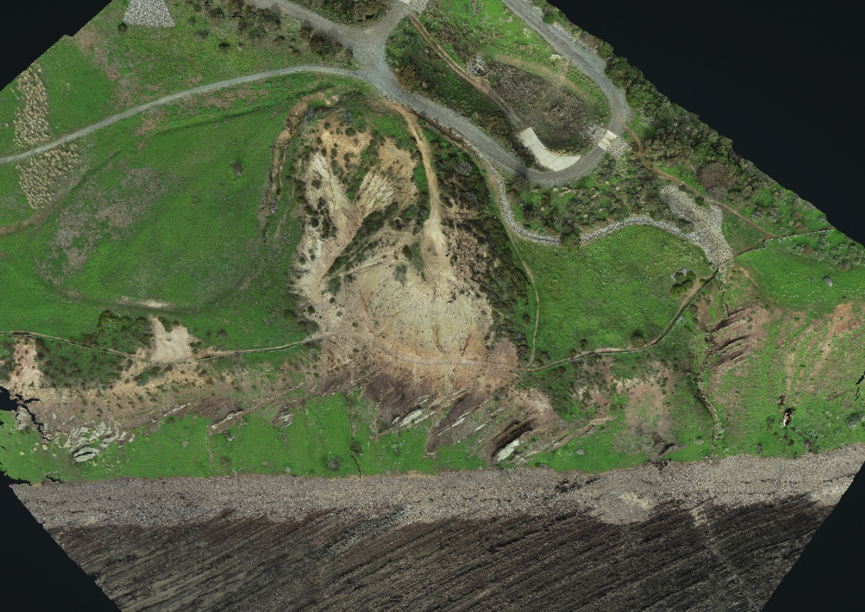
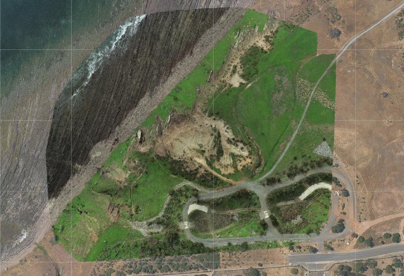
Recent Work
A sample of what we've captured — from volumetric surveys to orthomosaic terrain mapping.


CASA ReOC Licensed · South Australia · Fully Insured
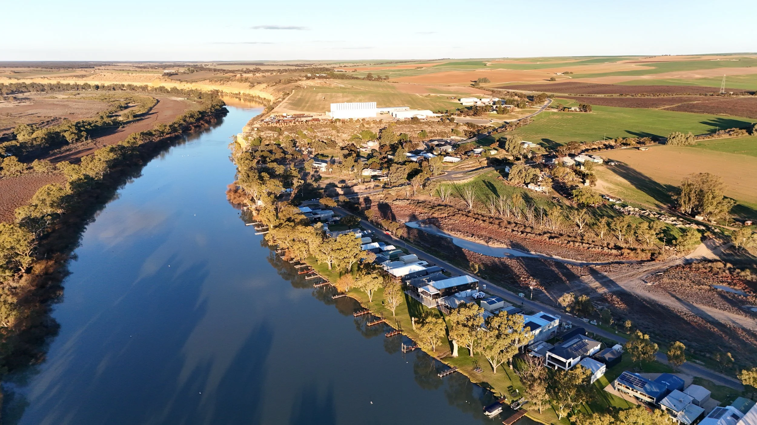
From the Murray to the Adelaide Hills — professional drone services for inspections, mapping, and photography. Precision you can act on.
What We Do
Whether you need a single inspection report or an ongoing aerial data program, we bring the right equipment, credentials, and attention to detail to every flight.
01
Roofs, solar panels, towers, and hard-to-reach assets — safe, fast, and documented. Avoid the cost and risk of scaffolding or manual access.
02
Accurate 2D orthomosaics and fully navigable 3D models from a single flight. Ideal for stockpile volumes, terrain analysis, and site documentation.
03
Precise elevation data and site mapping to inform planning decisions, track earthworks, and support engineering assessments.
04
Regular progress capture to keep stakeholders informed, document milestones, and identify issues before they become problems.
05
High-resolution stills and cinematic 4K footage for real estate listings, marketing campaigns, and property showcases.
06
Post-event damage assessments for insurers, councils, and asset owners — rapid deployment, comprehensive imagery, and clear reporting.
Portfolio
A sample of what we've captured — from volumetric surveys to orthomosaic terrain mapping.
"Data you can trust,
from a height you can't reach."
About Us
VirtualView is run by Andrew Bower, based in South Australia's Riverland and Adelaide. After two decades in enterprise IT — most of it with Cisco — Andrew made the move into commercial drone operations with one goal: bringing the same systematic, detail-oriented approach to aerial data that he applied to complex network infrastructure.
That means thorough mission planning, rigorous risk assessment, and deliverables that are actually useful. Not just pretty pictures — actionable data with context.
Operating from two bases — a property in the Mid Murray and a base in Adelaide — VirtualView is well-positioned to cover jobs across the Riverland, Murraylands, and metropolitan SA.
Get in Touch
Tell us what you need — whether it's a single inspection, ongoing monitoring, or something we haven't listed. We'll get back to you within one business day.
Frequently Asked Questions
VirtualView operates from two bases: Adelaide metro and the Mid Murray. We cover the Riverland, Murraylands, Adelaide Hills, and metropolitan Adelaide. We can also travel for larger projects throughout South Australia.
Yes, VirtualView holds a Remote Operator Certificate (ReOC), Remote Pilot Licence (RePL), and is AROC certified. We're also fully insured for commercial operations and conduct thorough risk assessments on every flight.
Pricing varies based on property size, location, urgency, and deliverables required. A standard residential roof inspection typically starts around $380. Contact us for a detailed quote specific to your project.
We operate DJI Phantom 4 Pro V2 (20MP camera with mechanical shutter) and DJI Mini 4 Pro (48MP camera). All imagery is GPS-tagged, and we process data through professional photogrammetry software for 3D models and orthomosaics.
On-site flight time is typically 30-60 minutes depending on property size. Standard deliverables (processed images and PDF report) are delivered within 5-7 business days via secure Google Drive link. Priority and urgent delivery options are available.
We can operate in controlled airspace with proper CASA approval. Sites near Adelaide Airport, Parafield, or other controlled aerodromes require additional processing time (3-5 business days) for approval and may incur an additional fee.